
The short answer
UNESCO inscribed five sites representing Bali’s subak system in 2012. The protected landscape includes rice terraces and the infrastructure, farmer groups and temples through which irrigation is managed. The case shows why protecting a working landscape requires attention to what people do as well as what visitors see.
A functioning landscape
Three parts of the subak system
Trace irrigation downhill, then trace the decisions that govern who receives water.
| Part of the system | What to observe | Why it matters |
|---|---|---|
| Water sources and channels | Lake, springs, canals and control points | They connect upstream and downstream places in a watershed. |
| Farmer associations | Groups sharing irrigation and customary rules | They organise the work of allocating and using water. |
| Water temples | Sites used in cooperative management and religious practice | They link practical water use with spiritual and social obligations. |
Chronology
A timeline of the turning points
Farmers maintain cooperative irrigation arrangements
Water-sharing practices, cultivation and religious life shape the landscape over time.
The Committee inscribes the subak landscape
Five sites illustrate interconnected water, farming and religious practices.
Managing the living landscape remains ongoing
The property documentation describes pressures on farming and the setting in which it takes place.
How terraces fit within a wider watershed
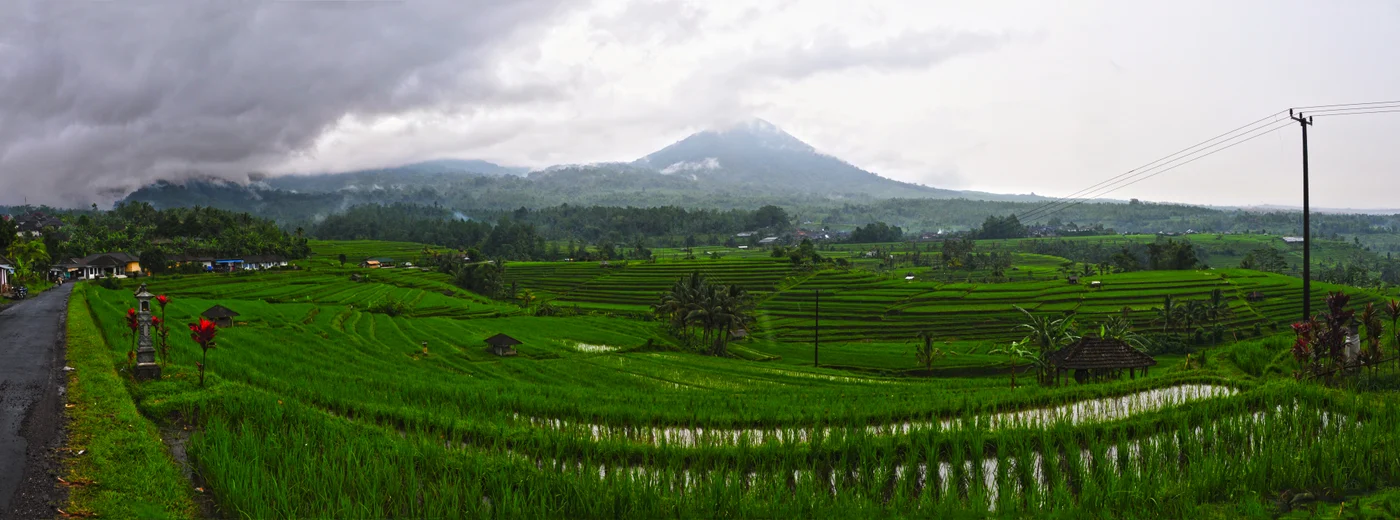
Terraces are the most visible part of the landscape. They rely on water that moves through a wider system of springs, canals and control points. The UNESCO record also describes forests, villages and temples as parts of the landscape. Read the terraces together with the places supplying and directing the water.
The Jatiluwih photograph shows one area. The inscribed components include places that represent other parts of the system, such as a watershed or a temple. A panoramic picture and a property map therefore answer different questions.
What farmer groups and water temples contribute
Farmers sharing a source have to make decisions about its distribution and their responsibilities. UNESCO reports that many subak groups record these arrangements in customary rules known as awig-awig. Water temples can be places through which communities organise irrigation as well as carry out religious practices.
The inscription invokes Tri Hita Karana, describing relationships between people, the natural world and spiritual life. In this case the philosophy helps explain why the Committee recognised a system still maintained through everyday practice.
Why protection includes the way land is used
A terrace can remain visible after changes in cultivation or water supply. The Committee’s account considers whether the processes that created the landscape continue. Its conservation discussion also includes pressure from development and tourism on the wider setting.
This focus distinguishes the landscape from a project chiefly concerned with how to treat an individual structure. Managing the subak property includes keeping room for the activities that give the structures their purpose.
Continue the chronology
Related history guides
How the Ifugao Rice Terraces Left UNESCO’s Danger List
See how irrigation, cultivation and maintenance also shaped conservation in Ifugao.
Read the timeline1973–1983How Borobudur Was Restored from 1973 to 1983
Compare how project records document the structural conservation of a different Indonesian property.
Read the timeline2008Why Melaka and George Town Share One UNESCO Listing
Compare the role of living traditions in another Southeast Asian inscription.
Read the timelineConnected biographies
People connected to this history
Quick answers
Common questions
- What does subak refer to in the listing?
- It refers to farmer cooperation and shared irrigation, including the physical structures and religious practices that support it.
- Are the Jatiluwih terraces the whole UNESCO property?
- They illustrate part of the listed landscape. The inscription includes five sites that represent different elements of the system.
Primary and institutional sources
How this history was checked
Dates, legal milestones and historical claims are checked against the official and institutional records below. This article was reviewed on 19 November 2026.