
The short answer
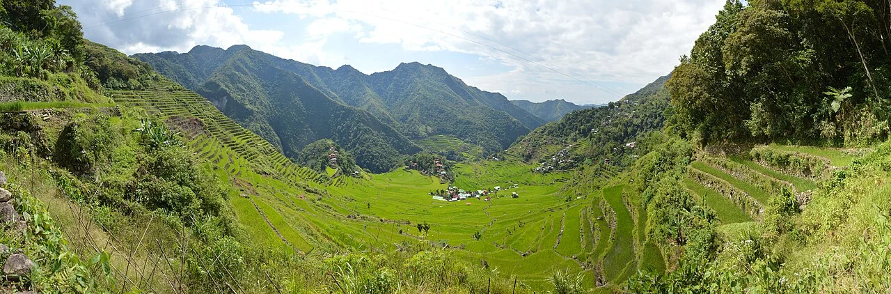
The Rice Terraces of the Philippine Cordilleras became a World Heritage property in 1995. UNESCO listed it as endangered from 2001 to 2012. That sequence concerns five terrace clusters in Ifugao, where irrigation, regular cultivation and the upkeep of walls depend on people continuing to work the land.
Identify the property
Which five clusters did UNESCO include?
The listing includes two clusters in Banaue municipality and three in neighbouring municipalities.
| Municipality | Cluster or clusters | Feature named by UNESCO |
|---|---|---|
| Kiangan | Nagacadan | Terrace rows divided by a river. |
| Hungduan | Hungduan | A pattern likened to a web. |
| Mayoyao | Central Mayoyao | Terraces alongside houses and granaries. |
| Banaue | Bangaan and Batad | A village setting at Bangaan and curved amphitheatre-like slopes at Batad. |
Chronology
A timeline of the turning points
The five terrace clusters are inscribed
The listing recognises a cultural landscape maintained over time by Ifugao communities.
The property enters the danger list
Loss of cultivation and pressures on management come under formal review.
The Committee removes the property from the danger list
The decision credits remedial efforts and identifies conservation work that remains.
Why repeated work keeps the landscape intact
Terrace walls need inspection and repair, while irrigation depends on water sources and working channels. Keeping the fields cultivated also sustains the knowledge involved in these tasks. When a field is abandoned, the longer-term effects can extend from the condition of a wall to how water reaches the plots below.
UNESCO’s 2012 decision credits Philippine efforts to address the threats and implement corrective measures. It still calls for ongoing management and monitoring. The decision is a statement about conservation status at that point in time.
What the name Banaue can mean in a listing
The property name covers five clusters in four municipalities. Banaue is one of the municipalities. Two of its clusters, Bangaan and Batad, are listed. Looking up the name of a municipality is therefore only the first step when a map or photograph is being used as evidence for a particular component.
Sources for this section: [1]
Why dating a terrace requires its own evidence
The long history of terrace building and a date for a particular field are different claims. Archaeologist Stephen Acabado modelled radiocarbon dates from the Bocos terraces in Banaue and compared findings with plant evidence from other sites. His studies place the expansion of intensive wet-rice cultivation in the settings studied within the Spanish colonial period. The approach gives a site-specific chronology. Each inscribed cluster needs its own dating evidence.
Those studies ask when and where particular agricultural changes occurred. The Committee’s 2012 decision addresses the condition of the inscribed landscape and what its conservation requires.
Continue the chronology
Related history guides
Connected biographies
People connected to this history
Quick answers
Common questions
- When did the terraces leave the danger list?
- The World Heritage Committee removed the property from the danger list in 2012.
- Which inscribed clusters are in Banaue municipality?
- Bangaan and Batad.
Primary and institutional sources
How this history was checked
Dates, legal milestones and historical claims are checked against the official and institutional records below. This article was reviewed on 19 November 2026.
- UNESCO World Heritage CentreRice Terraces of the Philippine Cordilleras property and boundaries
- UNESCO World Heritage CommitteeDecision 36 COM 7A.29 on conservation and danger-list removal
- Stephen Acabado, AntiquityA Bayesian approach to dating the Ifugao agricultural terraces
- Stephen Acabado, Journal of Anthropological ArchaeologyZones of refuge, a 2018 study of environmental practice in the Philippine highlands