
The short answer
On 24 January 1986, Voyager 2 passed about 81,500 kilometres above the cloud tops of Uranus. Its cameras revealed a moon with sharply contrasting terrain, while a different instrument showed that the planet’s magnetic field pointed in an unexpected direction. The contrast between those discoveries explains why a flyby needs several kinds of instruments.
The observations
What Voyager 2 measured at Uranus
Look at the quantity each instrument can record before interpreting the corresponding discovery.
| Target | Record | Finding |
|---|---|---|
| Atmosphere | Visible-light images through different filters | Subtle patterns become easier to detect when the contrast is enhanced. |
| Miranda | Imaging of the illuminated terrain | Fault canyons, ridges and surfaces with different textures. |
| Rings and moons | Images of the surrounding system | Additional ring structure and ten previously unknown moons. |
| Magnetic field | Measurements made by the magnetometer | A tilted field with a substantial offset from the centre. |
Chronology
A timeline of the turning points
Voyager 2 launches
The probe begins the mission that will eventually take it past the four giant planets.
Voyager 2 makes its closest approach
The spacecraft records clouds, moons, rings and magnetic measurements.
The trajectory reaches Neptune
The Uranus encounter helps set up the next planetary flyby.
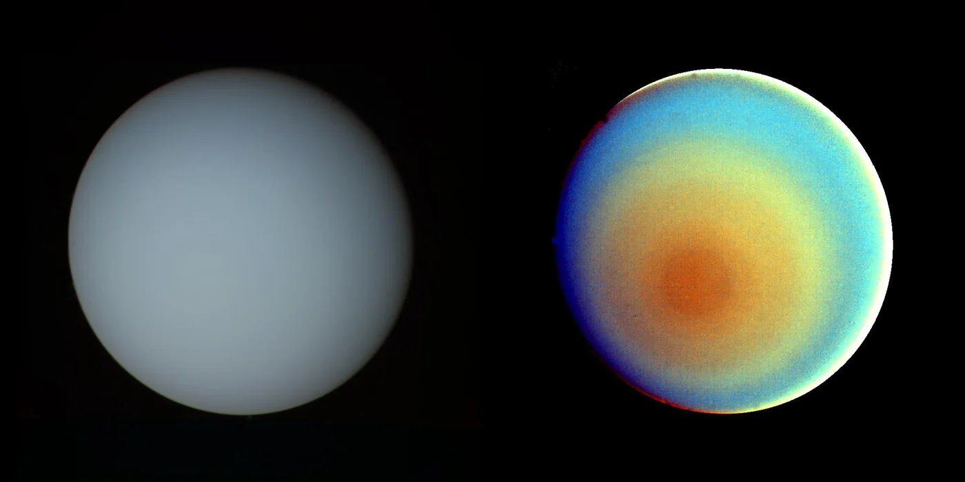
How to read the side-by-side views
NASA’s image record distinguishes a view assembled to approximate visible colour from a highly enhanced view made to bring out subtle structure. The second can make small differences in brightness easier to see. Its intense colours and edge effects should be read with the processing description rather than taken as the appearance a visitor would see.
A smooth-looking view of the disk therefore gives only one kind of evidence. Inspect the stated filters and the contrast processing before using a shaded band or sharp edge as proof of a feature.
What made Miranda an unexpected target
Voyager’s views show ridged areas, extensive fault canyons and sharply different kinds of terrain on the same small moon. The photographs made those contrasts visible. The process that produced the terrain is a separate question, and NASA’s fact sheet describes proposed explanations in that light.
The terrain record and the count of ten new moons address different things. Detailed images let scientists compare regions on Miranda. Repeated views of the surrounding system helped identify previously uncatalogued bodies.
Why magnetic tilt is a different measurement
A planet spins about one axis. Its field can be described by another. The roughly 60-degree tilt in NASA’s fact sheet compares these two axes. It is a separate quantity from the familiar tilt of Uranus’s spin axis relative to its orbit.
A tilted field offset from the centre produces different strengths and directions as the probe passes through the system. The flyby also recorded a twisted magnetic tail. Those findings come from field measurements rather than from the planet’s visible colour.
Continue the chronology
Related history guides
Connected biographies
People connected to this history
Quick answers
Common questions
- When did Voyager 2 visit Uranus?
- The spacecraft made its closest approach on 24 January 1986.
- What did Voyager 2 discover at Uranus?
- Its results included ten new moons, new ring details, complex terrain on Miranda and a strongly tilted, offset magnetic field.
Primary and institutional sources
How this history was checked
Dates, legal milestones and historical claims are checked against the official and institutional records below. This article was reviewed on 19 November 2026.