
The short answer
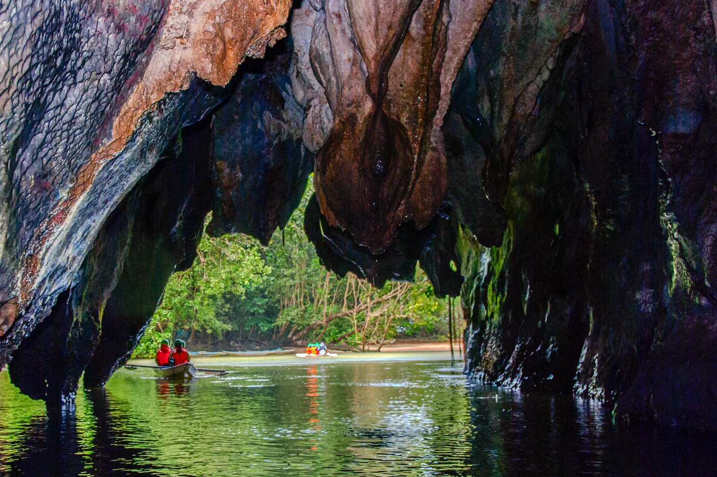
The underground river at Puerto Princesa flows through limestone and emerges directly into the sea. This connection allows the ocean tide to affect the lower cave and helps explain its brackish water. The 1999 World Heritage inscription also covers the forests and catchment connected to the cave.
Follow the water
What changes between upland, cave and coast
Each part of the landscape contributes to how the underground river functions.
| Part of the system | Prominent feature | Why it matters |
|---|---|---|
| Upland catchment | Forest and water draining into limestone terrain | Surface conditions influence the water reaching the cave. |
| Underground course | Channels through limestone and chambers | Much of the route must be documented below ground. |
| Lower cave and outlet | Direct link with sea and brackish water | The tide can influence the lower river. |
Chronology
A timeline of the turning points
The nomination documents the cave and catchment
The dossier relates water, limestone landforms and the coastal environment.
The park is added to the World Heritage List
The river’s unusual connection to the sea is a focal feature.
UNESCO distinguishes the lower river from the wider park
The description connects tidal influence, cave features and terrestrial habitats.
Why an underground river can also be tidal
Water following a cave route can still be connected to a changing sea level. At Puerto Princesa the channel opens directly onto the sea. UNESCO reports tidal influence and brackish conditions in the lower part of the underground river. Treat the outlet as a connection within the system, as well as a prominent entrance in photographs.
What the 8.2-kilometre figure represents
The figure describes the underground river in UNESCO’s property record. Different records may describe the length of a surveyed passage or one navigable section. These answer different questions. The size of a chamber describes another feature again. Knowing which length is being reported is important before comparing Puerto Princesa with another cave.
Why protection extends above and beyond the cave
Water arriving underground reflects conditions in the catchment. The listing considers the associated forest, karst landforms and long route to the sea. A photograph can show the dramatic edge. Managing the landscape involves places that are outside the camera’s frame but connected to the water.
Continue the chronology
Related history guides
What the 1977–78 Mulu Expedition Mapped
Compare passage surveying and the study of water movement in Sarawak’s limestone.
Read the timeline2009–2010How Tubbataha Extended Its Reef Protection
Compare the cave catchment with a protected marine property in the Sulu Sea.
Read the timeline2003–2025Why Phong Nha and Hin Nam No Share a Listing
Compare one cave river’s connection to the coast with a karst landscape divided by a national border.
Read the timelineConnected biographies
People connected to this history
Quick answers
Common questions
- Does the ocean affect the Puerto Princesa underground river?
- The river flows out to sea, and UNESCO describes its lower section as brackish and affected by the tide.
- What does the World Heritage property protect beyond the cave?
- It includes habitats and the wider landscape that link the mountains, underground course and coast.
Primary and institutional sources
How this history was checked
Dates, legal milestones and historical claims are checked against the official and institutional records below. This article was reviewed on 19 November 2026.