
The short answer
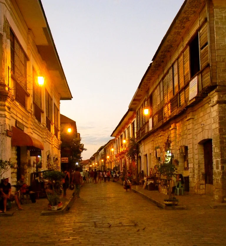
Vigan retains streets laid out in a Spanish colonial grid. Within that plan, the historic commercial district developed with strong Ilocano and Chinese influences. A street map tells one part of the story. The layout and uses of the buildings along those streets tell another.
Reading the town vertically and horizontally
What a street plan and a house plan each show
Look first across streets and squares, then from the lower floor of a building to the upper floor.
| Feature | Evidence to look for | What it can explain |
|---|---|---|
| Street grid | Blocks, intersections and relation to public spaces | How the official town plan organised movement and civic life. |
| Lower storey | Accommodation for trade | How households and shops participated in street commerce. |
| Upper storey | Living quarters | How a single building combined business and residence. |
Chronology
A timeline of the turning points
Street blocks and a civic centre take shape
The plan orders streets and places the main civic and religious buildings in relation to public space.
Merchant households occupy the historic core
Commerce and residence take place at different levels of many buildings.
The Committee inscribes Vigan
Its decision recognises the urban form and combination of cultural influences.
How a common grid can contain a distinctive town
UNESCO relates Vigan’s plan to the grid specified for Spanish colonial towns. The plaza area locates administrative and religious buildings relative to one another. The historic core, however, shows strong Chinese, Ilocano and other Filipino influences. The shared grid is the framework within which those local forms developed.
What the buildings add to a reading of the grid
A shop facing the street allowed commercial exchange on the lower floor. Upper floors could house the owners. That vertical division is a practical reason to examine a building section or description in addition to its façade. The exterior on Calle Crisologo supplies a view of the street, while the property documentation explains how the houses were used.
The records also distinguish the survival of the town plan from the state of individual houses. Many buildings have been modified over time. Continued use and the survival of key features take different kinds of evidence to establish.
Why the 1999 listing uses two criteria
The Committee’s decision recognises the combined cultural influences and the value of the surviving urban ensemble. The ensemble argument depends on how the structures fit into streets, blocks and public spaces. It can be read alongside Hội An, where the orientation of shops and alleys toward a river offers a different explanation for a trading town’s layout.
Continue the chronology
Related history guides
Connected biographies
People connected to this history
Quick answers
Common questions
- Was the grid the only reason Vigan was listed?
- The 1999 decision recognises both the urban ensemble and the distinctive mixture of cultural influences expressed in it.
- How did historic houses combine two uses?
- The lower floor could serve commerce, while the upper floor housed the owners.
Primary and institutional sources
How this history was checked
Dates, legal milestones and historical claims are checked against the official and institutional records below. This article was reviewed on 19 November 2026.