
The short answer
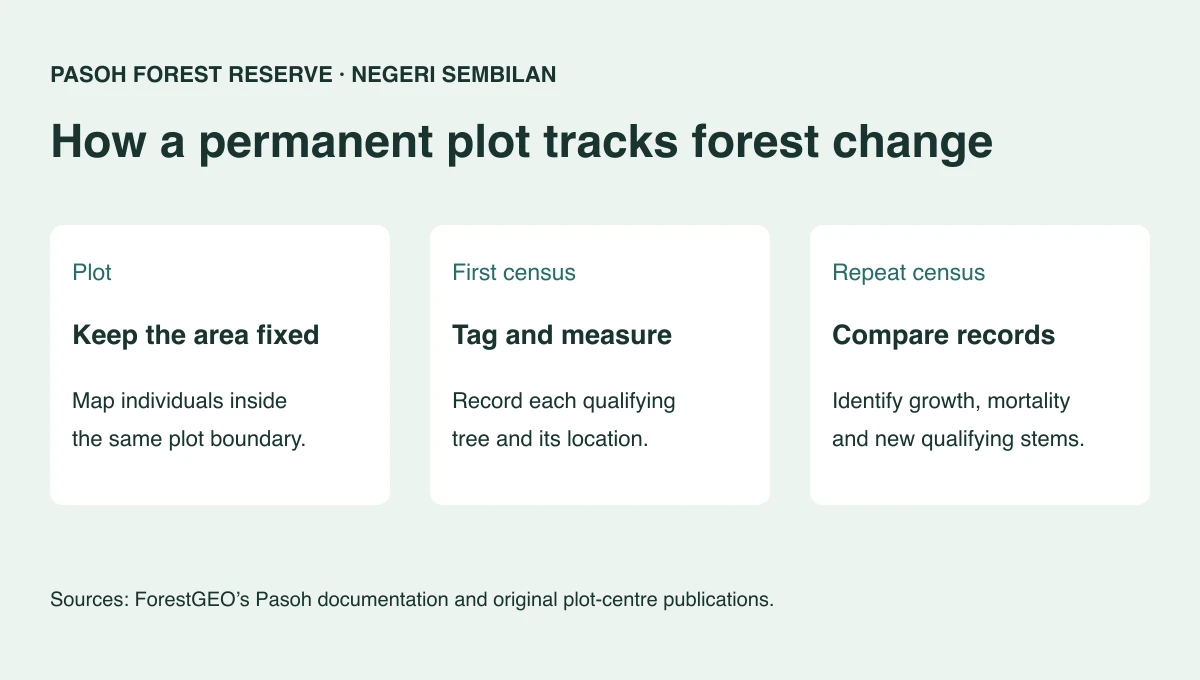
In 1985 researchers began a permanent forest census at Pasoh. The team marked out fifty hectares, tagged trees that met a defined size threshold and mapped their positions. Repeating the measurements in the same place let scientists distinguish changes in existing trees from deaths and the addition of new stems.
Why census design matters
What each part of the record enables
Repeating a survey can tell a different story from taking another photograph of the canopy.
| Feature | What researchers record | What it makes possible |
|---|---|---|
| Fixed area | A surveyed area of fifty hectares | Comparisons refer to the same area in each round. |
| Tags and positions | Individual identities and mapped locations | Later measurements can be matched to specific earlier records. |
| Size threshold | Qualifying trees at or above a defined stem diameter | A comparable count can include small stems while keeping an explicit cutoff. |
Chronology
A timeline of the turning points
Researchers establish the permanent plot
The Forest Research Institute Malaysia and collaborators undertake a mapped census in Negeri Sembilan.
Individuals receive identifiable records
Trees meeting the diameter threshold are identified, measured and mapped.
The same area and individuals are revisited
Records can reveal how trees change between measurements.
Why scientists chose a permanent plot
Pasoh’s 50-hectare plot was established in 1985 in Negeri Sembilan. The Smithsonian-hosted research report describes a collaboration involving FRIM and the use of a fixed area within the reserve. Keeping the boundary lets researchers compare surveys on the same ground.
A permanent boundary matters when sites differ across a forest. An increase or decline between counts is easier to interpret when both counts refer to the same area and use comparable inclusion rules.
What a tree record can reveal
The early protocol tagged, identified, mapped and measured qualifying trees, including stems at least one centimetre in diameter at breast height. A tag helps staff find an earlier record. A location helps when identities or the positions of neighbours are part of the research question.
Repeated observations make it possible to follow growth and mortality of the same individuals. A tree may newly appear in the qualifying dataset because it grew past the size cutoff, even if it had already been living in the plot.
How Pasoh became a comparison site
Researchers compared Pasoh with a separate fifty-hectare plot at Barro Colorado Island in Panama. A common plot area and broadly comparable census methods supported comparisons of community characteristics across the two sites.
The comparison still represents particular forests. A single plot can describe its tree community in detail, while comparisons across places or broader regional conclusions need other plots and evidence about how representative those places are.
Continue the chronology
Related history guides
How Kepong’s Forest Research Institute Grew a Forest
Follow FRIM’s separate earlier development of experimental nurseries and living collections.
Read the timeline1985 onwardWhat Danum Valley’s Catchments Revealed About Logging
Compare tree census records with long-term records of water and sediment.
Read the timelineConnected biographies
People connected to this history
Quick answers
Common questions
- When was the Pasoh forest dynamics plot established?
- FRIM and its collaborators established the fifty-hectare permanent plot in 1985.
- Why do researchers tag individual trees?
- Tags help link measurements of the same tree across census rounds so researchers can study growth and survival.
Primary and institutional sources
How this history was checked
Dates, legal milestones and historical claims are checked against the official and institutional records below. This article was reviewed on 19 November 2026.
- Smithsonian ForestGEOPasoh Forest Reserve plot account and census background
- Journal of Tropical Forest Science, original researchStand structure of Pasoh Forest Reserve from the fifty-hectare enumeration
- Smithsonian Institution repository, original researchDynamics of the Forest Communities at Pasoh and Barro Colorado: comparing two fifty-hectare plots