
The short answer
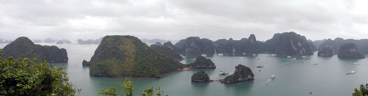
The limestone towers of Hạ Long Bay rise out of a drowned landscape. In 2023 UNESCO approved the addition of the Cát Bà Archipelago to the World Heritage property. The decision explains how the islands, sea and contrasting kinds of tower karst form a more complete geological and scenic record.
Read the limestone from the water
Distinguish a cluster of peaks from a single tower
Look at how neighbouring landforms are connected before deciding which form is visible.
| Feature | What to look for | What it helps explain |
|---|---|---|
| Fengcong | Conical peaks grouped on a connected base | Some parts of the landscape retain clusters of peaks. |
| Fenglin | Relatively isolated steep towers | Other parts show towers separated from their neighbours. |
| Marine invasion | Sea around and between limestone forms | Rising water has changed which parts of the karst are visible above the surface. |
Chronology
A timeline of the turning points
Hạ Long Bay enters the World Heritage List
The original inscription recognises the landscape’s natural beauty.
Geological significance is also recognised
The record comes to include evidence about the development of karst.
The Committee approves a boundary modification
Cát Bà is added to the property under the scenic and geological criteria.
Why a bay of islands can be evidence of an older landform
Karst develops as water dissolves soluble rock. In this region the resulting shapes include both groups of peaks and more isolated towers. The sea later surrounded many of those features. A view from a boat can therefore show landforms shaped by a long process on land and later seen in a maritime setting.
UNESCO uses the terms fengcong and fenglin for different arrangements of peaks and towers. The distinction depends on how the formations relate to each other, not just their outlines against the sky.
What adding Cát Bà changed
The 2023 decision names Cát Bà and approves the boundary change. The broader area represents a wider combination of island and marine settings. A new name records the enlarged set of places. The panorama reproduced here depicts Hạ Long Bay, one part of the expanded property.
Why 1994, 2000 and 2023 appear together
The dates concern the first inscription, a later decision recognising geological value and the expansion of the listed area. The 2023 decision applies criteria (vii) and (viii), for scenery and earth history. The property description also discusses ecosystems, which help describe the setting of the recognised limestone features.
Continue the chronology
Related history guides
Connected biographies
People connected to this history
Quick answers
Common questions
- When did Hạ Long Bay first become a World Heritage Site?
- Hạ Long Bay was inscribed in 1994. The Cát Bà Archipelago was added in 2023.
- What does marine-invaded tower karst mean?
- Limestone peaks and towers formed on land and were later partly submerged, leaving islands and towers surrounded by seawater.
Primary and institutional sources
How this history was checked
Dates, legal milestones and historical claims are checked against the official and institutional records below. This article was reviewed on 19 November 2026.