
The short answer
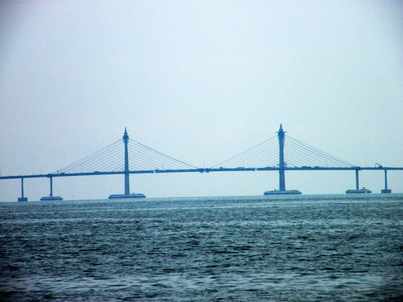
A road crossing of the Penang Strait had to join two existing road networks and cross water used for navigation. The first Penang Bridge, which opened in 1985, combined long approaches with a higher, cable-supported main span. Those parts answered different transport needs within one project.
Read the crossing by its parts
Why the bridge has more than one engineering form
The central span and the approaches connect as a single route.
| Part | Role | What to look for |
|---|---|---|
| Land connections | Join the bridge to streets and highway links | Where vehicles enter and leave the crossing. |
| Approaches | Carry the road across stretches of water | Repeated supporting spans. |
| Main span | Crosses the principal navigation opening | Towers and cables supporting the roadway. |
Chronology
A timeline of the turning points
Island and mainland depend on water crossings
The fixed crossing changes the route available to road vehicles.
Major approaches and a central span are built
Marine work and land connections have different requirements.
The crossing opens
The Malaysian Highway Authority identifies 14 September as the opening date.
Why the structure changes form over the strait
A bridge across a wide waterway can repeat shorter spans where it is practical to place supports. The principal navigation opening needs different treatment. The cable-supported section concentrates the larger crossing at that part of the route, while the approaches keep the road moving toward land.
This explains why an engineering drawing shows several types of span even though motorists use them as a continuous crossing.
What changed for road transport
A fixed bridge gives vehicles a continuous route so their journey need not include boarding a vessel. The benefit depends on the connections to the road network on either side. Those links determine which trips can use the crossing and how access changes for the places it serves.
How to identify the first crossing in a dated account
The Malaysian Highway Authority records the 1985 opening for this bridge. Later accounts of a second crossing document a separate project. When comparing lengths or dates, first identify the crossing and whether the figure describes the bridge works or a longer route with approaches.
Continue the chronology
Related history guides
How Penang’s Ferry Service Changed from Car Decks to Catamarans
Compare the subsequent history of the road and passenger ferries that still linked the island and the mainland.
Read the timeline1994How Malaysia Opened the North–South Expressway
Compare a single water crossing with the completion of a much longer road corridor.
Read the timeline1973What the San Juanico Bridge Connected in 1973
Compare another fixed crossing between separated parts of a road network.
Read the timelineConnected biographies
People connected to this history
Quick answers
Common questions
- When did the first Penang Bridge open?
- The Malaysian Highway Authority gives 14 September 1985.
- Why does the middle look different from the approaches?
- A cable-supported main span crosses the principal navigation opening, while shorter spans carry more of the approaches.
Primary and institutional sources
How this history was checked
Dates, legal milestones and historical claims are checked against the official and institutional records below. This article was reviewed on 19 November 2026.