
The short answer
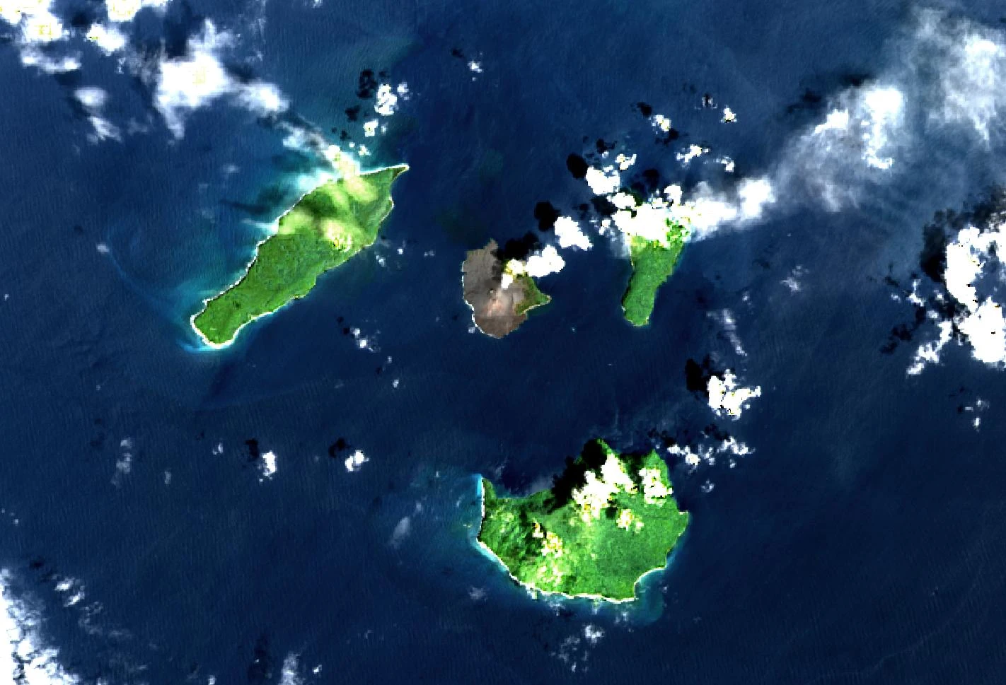
A satellite image taken on 20 December 2018 shows Anak Krakatau before a section of the younger volcanic island collapsed. Two days later, material entered the Sunda Strait and generated waves. Researchers looked at changes at the volcano, instrument records and the traces left by water at the coast to reconstruct what had happened.
Reading the records
Measurements from the island to the shoreline
An island shape, a gauge reading and a trace on land describe different points in the event.
| Observation | Measures | Use |
|---|---|---|
| Satellite imagery | Change in island geometry. | Locates the part of the flank that failed. |
| Tide gauge | Water level at the instrument. | Constrains wave arrival and local amplitude. |
| Field survey | Vertical run-up and inland reach. | Measures effects at named coastal sites. |
Chronology
A timeline of the turning points
Pre-collapse Landsat scene
The image records the island before the flank failure.
Southwestern flank failed
The collapse displaced water in the Sunda Strait.
Coastal surveys
A field team measured run-up and inundation at individual sites.
A collapse generated the waves
The research combines changes in the island’s shape with instrument records and modelling. A flank failure transferred material into the sea and provided a source for the tsunami. Images taken before and after the failure establish what changed on the island. A single earlier image, such as the one on this page, provides one side of that comparison.
The shoreline gives more than one measurement
A January survey reported a run-up of 9.2 metres at one Tanjungjaya site and an inundation distance of 286.8 metres at a site in Cagar Alam. Run-up is a vertical elevation reached by water. Inundation distance measures reach inland. Those two examples come from different locations and cannot be used together as the dimensions of one observed wave.
Sources for this section: [3]
Why the mechanism matters in the historical record
In plate-boundary tsunami research, a large earthquake is often the starting point for source reconstruction. At Anak Krakatau, the shape change of the island and the timing of the waves gave investigators different constraints. The episode shows why an account based on only one kind of instrument can leave the sequence unclear. Coastal measurements then establish variation in impact along the strait.
Continue the chronology
Related history guides
How Instruments Recorded Krakatau’s 1883 Eruption
Compare the 2018 collapse with the separate nineteenth-century eruption.
Read the timeline2018–2020Why Scientists Debate the Sources of the Palu Tsunami
Compare the evidence for how waves formed in Palu Bay.
Read the timeline2008How Indonesia Launched Its National Tsunami Warning System
Read why national warning systems collect different kinds of observations.
Read the timelineConnected biographies
People in this history
Quick answers
Common questions
- What caused the 2018 Sunda Strait tsunami?
- Research traces it to a collapse of the southwestern flank of Anak Krakatau into the sea.
- Is run-up the height measured at a tide gauge?
- Run-up describes an elevation reached on land. A coastal gauge records the change in water level at its own location.
Primary and institutional sources
How this history was checked
Dates, legal milestones and historical claims are checked against the official and institutional records below. This article was reviewed on 19 November 2026.